Fleet Management – MyEROAD Fleet Map
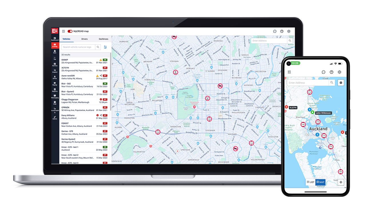
Track and manage your fleet in real time with MyEROAD Fleet Map
Save time, maximise fleet productivity and enhance customer service with EROAD’s vehicle location tracking, activity monitoring and intelligent GPS route planner app.
EROAD’s fleet management system is more than dot-on-the-map technology. MyEROAD Fleet Map puts vital fleet information at your fingertips for better, faster decision making.
“EROAD is integral to our business and how we manage the fleet and the health and safety of our people, they’re more than just a telematics provider,” – Josh Hedley, National Fleet Manager at Downer NZ
Accurate vehicle and asset tracking hardware combined with intelligent software, lets you go from a birdseye view of your entire fleet, to getting the latest route-compliant ETA on a customer delivery in just a few clicks. MyEROAD Fleet Map can help:
- Ensure safety
- Improve job management
- Set and exceed customer expectations
- Discover operational efficiencies
- Comply with on-road restrictions
- Empower your team
- Save time & resource
- And much more!
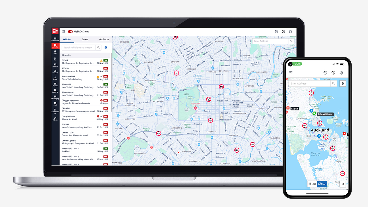
One platform, multiple features across your whole team
EROAD’s highly accurate asset and vehicle tracking solutions deliver near real-time data straight to your back office. The Fleet Map is accessible by fleet managers, health & safety as well as dispatch and logistics. No more time wasted trying to contact drivers on the move, or staff not knowing what’s happening with specific deliveries or vehicles.
Better visibility
Fleet management
View entire fleet with intelligent clustering*
Locate any driver, vehicle, asset or trailer
Create and view geofences
Logged out? Reboot where you left off
View duty status & real time logbook data***
Optimise route planning
Dispatch and logistics
Display truck restrictions & live traffic insights
Use filters to find the best route
Get accurate ETAs
Find vehicle closest to a pick up/drop off
Transport & logistics related points of interest
Sort driver list by most work-hours remaining***
Enhance driver safety
Safety & coaching
View vehicle status
Access previous trip details
Investigate driving alerts and speeding locations
Request footage at specific journey points**
* Up to 100,000 vehicles or assets can be displayed at one time
** Access to video footage requires EROAD Clarity Solo, Get or Connected.
*** Requires EROAD Day Logbook subscription. The logbook user must be in coverage when changing duty status for it to reflect in real-time on the map.
Intelligent route planning software
We’ve integrated EROAD’s truck, traffic and satellite map technology into our route planning and Estimated Time of Arrival (ETA) tool.
When you want to plan a route or check a vehicle’s ETA, you can get an accurate and compliant route for your vehicle and load type by simply changing the route filters.
By applying filters, and inputting vehicle or load information, fleet managers and dispatchers can be more confident in the suggested routes and journey times, knowing that important restrictions have been accounted for – such as truck weight, height, width, and hazardous materials that are hauled.
You can also select common routes to avoid, such as; tolls, tunnels, difficult turns, and more.
Additionally, these restrictions and road types are clearly defined on the map, along with transport-related points of interest and detailed industrial/built-up areas to make it easier to plan, including weigh bridge stations, loading docks and delivery entrances.
Key highlights
- Truck specific routing that considers vehicle weight and dimension restrictions
- Avoid common obstacles like difficult turns and controlled access roads
- Comply with road regulations including hazardous load restrictions
- Plan routes ahead of time with configurable start points and multi stops
- Discover transport & logistics points of interest
- Easily re-order stops
- Get realistic arrival times with live traffic insight
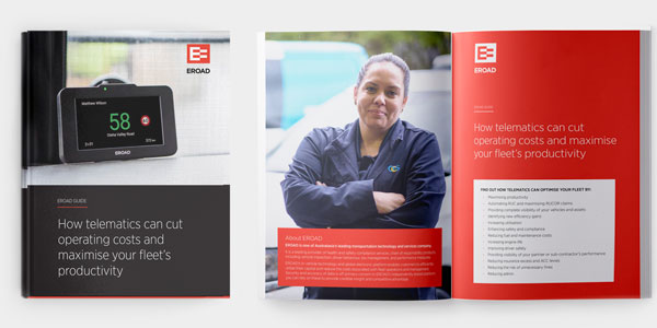
Want to learn more about how EROAD can help your fleet improve productivity?
Fleet tracking & routing software designed for busy fleet operators
Enhanced visibility simplifies dispatch and job management, improving communication between dispatch and drivers, and helping you meet agreed customer service levels. Truck road regulations and real time traffic insights on the map provide a view of any restrictions, and the integrated delivery route planner enables your team to find a compliant and efficient route for your vehicles height, width, weight and load type. The MyEROAD Fleet Map gives you the essential information, as you need it, enabling you to get things done easier and faster.
“Without EROAD we wouldn’t have been able to see the location of any of our vehicles unless we called them on the radio. Using EROAD’s fleet management, we knew at a glance exactly where they were, identify where there were gaps, and choose the appropriate vehicle for the event.” Chris Herbert, Porirua City Council (NZ)
EROAD’s vehicle tracking system puts fleet insights at your fingertips
EROAD’s web portal, MyEROAD has been designed with fleet professionals in mind.
- Total visibility in real time with activities and stops
- See where every vehicle is and drill down for detail on status, speed, and activities
- Replay routes taken with animated journey lines and see safety events during the trip
- Set up geofences and track when vehicles enter and exit and the duration of stay in the area
- View driver duty status and real-time logbook hours for compliant job scheduling (requires Logbook subscription)
- A map designed for fleet managers, with emphasis on industrial zones, built-up areas, businesses and transportation points of interest
- Monitor operations to ensure productivity
- Provide accurate ETAs
- And much, much more
Plus, the Fleet Map and route planner on the MyEROAD app works anywhere, anytime, on any connected smart device, giving fleet managers a new level of convenience and flexibility.